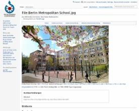
Farbfoto
CC BY-Metropolitan School SA 3.0
http://creativecommons.org/licenses/by-sa/3.0/deed.de
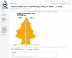
Farbgrafik
Die Bevölkerungspyramide des Berliner Bezirks Mitte am 31. Dezember 2009 nach Alter und Geschlech
CC BY- Jwnabd SA 3.0
http://creativecommons.org/licenses/by-sa/3.0/deed.en
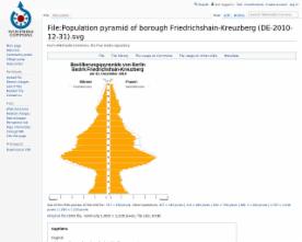
Farbgrafik
CC BY-JwnabdSA 3.0
http://creativecommons.org/licenses/by-sa/3.0/deed.en
machen tolle Touren durch Berlin, interesant für Einzelpersonen, evtl. auch für Klassenfahrten...
She is working successfully in Germany with Geo-Caching events, have a look at her WS- she is also doing this in cities- I talked to her and I think this is very interesting and we might be able to apply a lot of her stuff in BCN. She specializes in children-birthdays up til now. But she is currently investing in an app- which is due for summer where people can easily create their own geo-caching tours- so this is really something to explore…
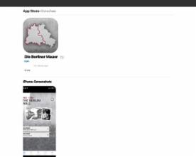
Die Berliner-Mauer-App von der BpB scheint ein Höhepunkt der Applikationen im Bildungsbereich zu sein.



Senatsverwaltung für Stadtentwicklung und Umwelt: Stadtentwicklungskonzept Berlin 2030 (StEK 2030) und Stadtforum 2030: Berlin - Stadt im Wandel -